Existing conditions survey, cost and scope of the architectural site survey your design starts from
An existing conditions survey is a sealed boundary and topographic survey of a site as it stands today: property lines, buildings, pavement, grades, drainage, trees and utilities, all tied to one benchmark. Architects and engineers design from it, and under the standard AIA owner and architect agreement the owner, not the architect, furnishes it. A residential lot usually costs $1,500 to $3,500 and a small commercial site $3,000 to $6,500. Describe the project once and compare up to 3 quotes from licensed land surveyors.
Licensed surveyors · scoped requests · free for clients Up to 3 quotes, matched to your parcel
The price range and turnaround for the job you describe appear here.
Traverse
Estimate for ,
typical local range · on site to drawing
A published range for this type of work, not a quote. Send the request and surveyors listed for your county reply with their own price.
Free for clients · You choose who to talk to
What an existing conditions survey is, and who orders it
An existing conditions survey is the base drawing a renovation, addition or site redevelopment is designed on. A licensed land surveyor runs the boundary, locates everything built on the lot, measures the ground in enough detail to draw contours, and records what can be found of the utilities. The architect or civil engineer then lays the new work over it, so every setback, ramp slope and drainage line in the permit set is only as good as this drawing.
The request usually arrives as one line in an architect's proposal: "Owner to provide survey." That line comes from the standard contract. Section 5.4 of AIA Document B101-2017, the most common owner and architect agreement in the US, says "The Owner shall furnish surveys to describe physical characteristics, legal limitations and utility locations for the site of the Project." Section 3.1.2 of the same document says the architect is entitled to rely on the accuracy and completeness of information the owner furnishes. In plain terms, you hire the surveyor, you pay for the survey, and you carry the cost of any error in it.
Who buys this: a building owner, developer, church or school board, or a homeowner planning a large addition, usually once the architect is signed and before schematic design starts. The architect often writes the scope and recommends a firm, but the contract and the invoice sit with you, which is why it pays to compare quotes on the same scope.
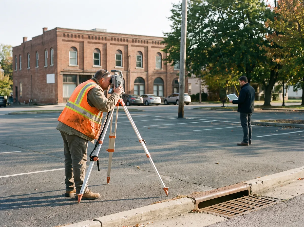
The scope list your architect expects, translated into survey items
Section 5.4 of AIA B101-2017 lists what the owner-furnished survey should include "as applicable". The left column quotes that list. The right column is what to write into the surveyor's scope so the quotes you compare cover the same work.
| What B101 Section 5.4 asks for | What to put in the survey scope |
|---|---|
| Grades and lines of streets, alleys, pavements | Right-of-way lines, edge of pavement, curb and gutter, sidewalk, spot grades along the frontage |
| Adjoining property and structures | Neighboring buildings and walls within a set distance of the line, with their use and height if zoning needs it |
| Designated wetlands and adjacent drainage | Wetland flags located if a scientist has delineated them, swales, inlets, culverts, headwalls |
| Rights-of-way, restrictions, easements, encroachments, zoning, deed restrictions, boundaries | A boundary survey read against the title commitment, with plottable easements drawn and encroachments noted |
| Contours of the site | Contour interval stated in the quote (1 foot is typical for building design) plus spot elevations at key points |
| Existing buildings, other improvements and trees | Building footprint, finished floor and door threshold elevations, walls, fences, trees above a stated trunk diameter |
| Utility services and lines, above and below grade, including inverts and depths | Poles, meters, valves and manholes located, pipe inverts measured in structures, record and 811 mark-outs shown, deeper work quoted separately |
| All information referenced to a Project benchmark | A benchmark set on site, the vertical datum (usually NAVD 88) and the horizontal coordinate system named on the drawing |
Quotes differ most on three lines: the contour interval, the tree size cutoff, and how far the utility work goes. Ask each firm to state all three. Interior floor plans of an existing building are a different service: B101 lists existing facilities surveys separately, under Supplemental Services in Section 4.1.1, and they are usually done by the architect or a scanning firm rather than a land surveyor.
How much does an existing conditions survey cost?
An existing conditions survey on a typical residential lot costs about $1,500 to $3,500, roughly a boundary survey and a topographic survey bought together. A small commercial site under an acre runs about $3,000 to $6,500, and larger or busier sites more. These are market ranges from US survey quotes, not a fee schedule.
| Site | Typical cost | What moves the price |
|---|---|---|
| Residential lot, house addition or major renovation | $1,500 - $3,500 | Lot size, tree count, how much of the street frontage is picked up |
| Small commercial or institutional site, under 1 acre | $3,000 - $6,500 | Parking lot detail, drainage structures, adjoining buildings |
| Commercial site, 1 to 5 acres | $5,000 - $12,000 | Contour interval, utility density, record research |
| Update of an existing survey by the firm that made it | $400 - $1,200 | What changed on site since the last visit |
| Underground utility designating with ground penetrating radar or electromagnetic locators | Quoted separately | Usually a specialist subconsultant, priced by area or by day |
| ALTA/NSPS survey, when a lender or buyer is also involved | $2,500 - $10,000+ | Table A items selected, title commitment review |
The cheapest quote is often a boundary survey with a few spot grades, which is not a design base. If the architect later needs contours, inverts or tree locations, the crew goes back out and you pay a second mobilization. Ask for a single scope up front. Compare the topographic survey and property line survey pages if you only need one half.
How far should the utility locating go?
Most arguments about an existing conditions survey are about what lies underground. The national standard, ASCE 38-22, grades utility information in four quality levels. Naming the level in your scope is the cleanest way to stop comparing a records sketch with a field-verified map.
| Quality level | What it means | Who usually does it | When it is enough |
|---|---|---|---|
| QL-D | Taken from utility records or recollections only | Surveyor or engineer, desk research | Early planning and budgeting |
| QL-C | Visible structures (manholes, valves, meters, poles) surveyed and matched to records | Land surveyor, part of the normal field work | Most residential additions and many renovations |
| QL-B | Horizontal position of buried lines found with geophysical methods and surveyed | Utility designating subconsultant, then located by the surveyor | New foundations or trenching near known lines |
| QL-A | Utility exposed by vacuum excavation and measured in three dimensions | Specialist crew | Tight conflicts, deep structures, critical crossings |
Quality levels as defined in ASCE 38-22 and summarized by the Federal Highway Administration. A land surveyor's standard existing conditions work usually delivers QL-C. The public 811 locate service marks lines for excavation; it is not a design survey and its paint only lasts a short time.
How an existing conditions survey job runs
1.
Get the scope from your architect
Ask for the limits of work, contour interval, tree cutoff, utility quality level and the file format they design in (usually AutoCAD or Civil 3D). Send the title commitment if you have one.
2.
Compare quotes on the same scope
Post the job once and get up to 3 quotes. Check that each one names the same deliverables, datum and turnaround, not just a price.
3.
Field work and record research
One to several days on site depending on size, plus deed, plat and utility record research at the office.
4.
Sealed drawing and CAD file
Expect a signed and sealed PDF plus the CAD file in two to four weeks for a typical site. Your architect designs directly on the CAD file.
Why a laser scan, an old plat or county GIS does not replace the survey
A laser scan or photogrammetry model records the shape of a building very well, and architects use them for existing facilities work. It does not tell you where your property line is. Setbacks, lot coverage and encroachments are measured from the boundary, and only a licensed land surveyor can establish that line. A permit reviewer who finds the addition drawn 4 feet from a line nobody surveyed will send the set back.
County GIS contours and parcel lines are drawn for mapping, not design. Parcel lines on a tax map can sit several feet off the true boundary, and the contours often come from a regional elevation model at 2 foot intervals or coarser. They are fine for a feasibility sketch and wrong for a ramp, a retaining wall or a drainage design.
An old closing survey is a better start but rarely enough. It shows the lot lines and the house footprint, usually without contours, inverts, trees or a benchmark. The practical move is to call the firm that made it: they already hold the record research and control, so an update and upgrade to a full existing conditions survey usually costs less from them than from a new firm.
Existing conditions survey questions
How much does an existing conditions survey cost?
A residential lot usually costs $1,500 to $3,500 and a commercial site under an acre $3,000 to $6,500. Larger sites, dense parking and drainage systems, and a tight contour interval push it higher. Underground utility designating by a specialist is normally quoted on top. Compare quotes on the same written scope, or the numbers will not line up.
Who pays for the survey, the owner or the architect?
The owner. Section 5.4 of AIA B101-2017 says the owner shall furnish surveys describing the site, its legal limitations and utility locations, and Section 3.1.2 lets the architect rely on that information. Some architects will subcontract the survey for convenience, but the cost still comes back to you, often with a markup.
What is the difference between an existing conditions survey and a topographic survey?
A topographic survey measures the ground and features to draw contours. An existing conditions survey adds the boundary, easements, buildings, utilities and trees, so it is a topographic survey plus a boundary survey plus the design details an architect needs. If you only need grades for drainage, a topographic survey may be enough.
Does an existing conditions survey include the inside of the building?
Usually not. A land surveyor measures the site and the outside of the building. Interior floor plans are an existing facilities survey, a separate service listed under Supplemental Services in AIA B101, and are typically done by the architect or a laser scanning firm. Say which one you need when you ask for quotes.
How long does an existing conditions survey take?
For a typical residential lot or small commercial site, expect about two to four weeks from signed proposal to sealed drawing and CAD file. Field work is one to three days; record research and drafting take the rest. Large sites, winter leaf-off timing for trees, or utility designating subconsultants add time.
Can I reuse the survey from when I bought the property?
Partly. It can confirm the boundary and save research time, but it rarely has contours, pipe inverts, trees or a benchmark, and it may be years out of date. Ask the firm that made it to update and extend it; that is usually the cheapest route to a design base.
Three quotes beat six voicemails
Describe the parcel once. Your scoped request goes to licensed surveyors listed for your county and they quote it themselves. Posting is free for clients and quotes are never marked up.